Space geodesy
The field of geodesy originally discovered the shape of Earth and then went on to define the oblateness and roughness of our almost spherical planet. Geodesy is now concerned with changes in the shape of Earth’s surface, as small detectable changes are associated with issues of significant societal impact such as ice melting, sea level rise, land subsidence, and aquifer depletion. For example, the rate of polar ice melt may be estimated from combined satellite gravity and ground GPS measurements. Global estimates of sea level changes are measured by altimetry satellites within entire ocean basins. Human-induced depletion of aquifers is reflected in subsidence measured by SAR satellites.
Space geodesy uses a set of techniques relying on precise distance or phase measurements transmitted or reflected from extraterrestrial objects, such as quasars, the moon, or artificial satellites. Early space geodetic measurements beginning in the 1980s had a 5-10 cm accuracy level, were conducted across the entire globe, and yielded the first direct observations of tectonic plate motion. Further improvements to space geodetic technologies have increased the accuracy to the current sub-centimeter level. Today, space geodetic observations can detect small movements of the Earth’s solid and fluid surfaces as well as changes in the atmosphere and ionosphere. Hence, geodesy has many applications in various fields extending well beyond its traditional role in solid Earth (Figure 1).
Space geodesy provides observations at various spatial and temporal scales with a corresponding variety of applications (Figure 1). In two review articles, we summarized the contributions of space geodetic observations to various Earth science disciplines. In the study “Geodesy in the 21st Century”, we described the various space geodetic technologies and their applications (Wdowinski and Eriksson, 2009). In the study “Observing and understanding the Earth system using space geodetic techniques”, we described current space geodetic techniques and recent results of observing and understanding the Earth system, including atmospheric-ionospheric sounding, ocean monitoring, hydrologic sensing, cryosphere mapping, crustal deformation and loadings, gravity field, Earth rotation and atmospheric-solid earth coupling (Jin et al., 2013).
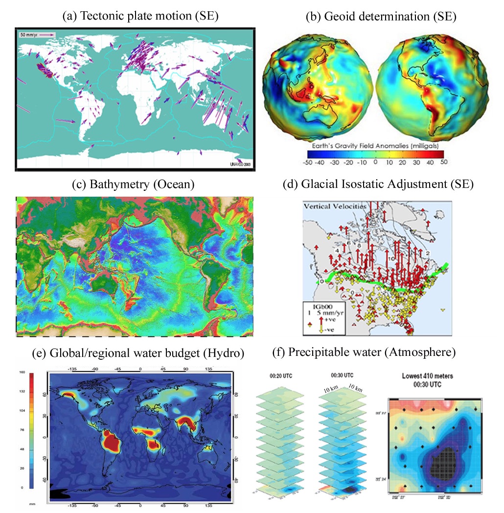
Figure 1. Space geodetic applications in various Earth science disciplines at global and continental scales. SE stands for solid Earth, and Hydro represents hydrology. [Source: Wdowinski and Errikson (2009)]
Space geodesy publications: Wdowinski and Eriksson (2009); Jin et al. (2013);