Arctic Observing Networks:
Collaborative Research: Sustaining and amplifying the ITEX AON through
automation and increased interdisciplinarity of observations
Project Summary poster (jpeg 1.4 M)
Arctic
Observing Networks: Collaborative Research: Sustaining and amplifying
the ITEX AON through automation and increased interdisciplinarity of
observations.
Proposed activities
The
International Tundra Experiment (ITEX) Arctic Observing Network (AON)
collects data on phenology, plant growth, community composition and
ecosystem properties as part of a greater effort to study environmental
change in the Arctic. The network, started in early 1990’s, now
provides tremendous value for detecting changes within long-term
experimentally warmed and control plots across a range of sites and
ecosystems that span the major vegetation types of the Arctic.
While of great value, these manually collected measurements are labor
intensive and time consuming, greatly restricting frequency and spatial
extent of sampling. Recent advances in sensor technology hold the
promise to allow sampling of surrogates of these manual measurements
rapidly and over large areas. Here we will continue the ITEX AON
observations and initiate a suite of related, non-intrusive structure,
reflectance and thermal measurements using robotic sensor platforms
(networked infomechanical systems, NIMS). These new measurements
will allow us to scale our measurements to the regional level by
linking to existing 1 km2 sample vegetation grids and satellite
imagery, providing urgently needed data critical to our understanding
of the impacts of changing tundra vegetation on the interactions
between the land and the atmosphere for the Arctic and the global
system, including carbon and water fluxes and energy balance.
This project will specifically:
1)
Build on the power of the ITEX experiment by continuing to monitor the
long-term changes in phenology, vegetation structure and composition
change, and their ecosystem consequences in response to experimental
warming and background climate change. The data, from which we
have records going back over a decade, provide firm benchmarks to
document change. The small scale and extreme heterogeneity of
tundra communities requires continued manual measurements of phenology
and plant community composition, which we will conduct on our ITEX
experimental and control plots. To link phenology and community
composition to ecosystem function we will continue measurement of key
indices of ecosystem function including plant and soil stable isotopes
ratios, nutrients, plot-level spectral reflectance, and components of
CO2 exchange of the existing ITEX plots.
2)
Establish vegetation grids at each location to increase spatial
coverage. We will monitor vegetation change at the landscape
level with the use of existing 1 km2 ARCSS grids in Alaska and a new
spatial grid in Greenland. Within the grids we will monitor
vegetation changes at the plot level for each vegetation type. We
will also use high-resolution satellite imagery to develop fine-scale
vegetation maps of the ARCSS/ITEX grids at each site.
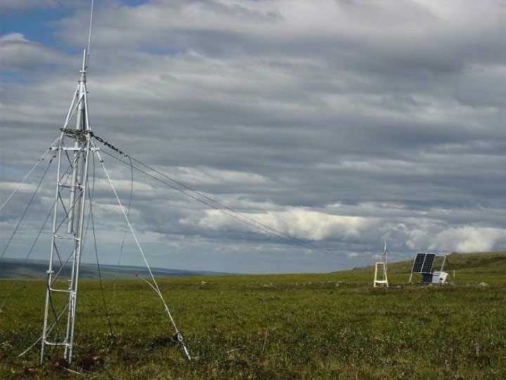
3)
Install infrastructure for automated monitoring of surrogates for plant
phenology, vegetation structure, and ecosystem function across our
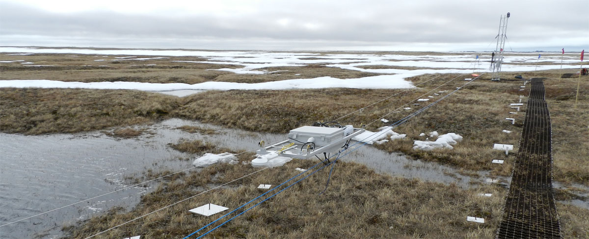
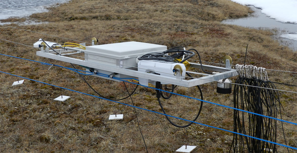
arctic transect. We will install mobile sensor systems
instrumented with a comprehensive suite of sensors and imagers within
the vegetation grids at each site. These platforms will provide
the link between manual and automated measurements and increase the
scale and frequency of sampling. Because the sensor platforms are
highly expandable, additional sensors can be added as new technology
develops. These measurements should greatly increase the
scalability and interdisciplinary usage of the datasets.
(4)
Scale up ITEX measurements using the ARCSS grids and multiple remote
sensing approaches. We will develop capacities for scaling
metrics of plant and ecosystem function from the plot to regional
level. Spectral reflectance measurements will be made at the plot
level, from a semi-autonomous robotic sensor array mounted on overhead
cables, and from high spatial resolution satellite imagery. Plant
canopy structural measurements will be made at the plot level, from
distance and range finder sensors on the robotic cable system, using
geo-referenced ground based LiDAR. Specifically, these
measurements will permit the mechanistic drivers of change in plant and
ecosystem spectral properties and canopy development and the
implications of these on ecosystem function to be understood and traced
across a range of spatial and temporal scales.
Participants
Steve Oberbauer - Florida
International University (http://www.fiu.edu/~oberbaue/)
William Gould - Institute
of Tropical Forestry
Robert Hollister- Grand
Valley State University
Craig E. Tweedie- University of Texas El-Paso
Jeff Welker - University
of Alaska Anchorage
Nathan Healey (Jet Propulsion Lab)
Roxaneh Khorsand (Northern Colorado University)
Jose Luciani (Florida International University)
This material is based upon work supported
by the National Science Foundation. Any opinions, findings, conclusions,
or recommendations expressed in the material are those of the
author(s) and do not necessarily reflect the views of the National
Science Foundation.