Tectonic research
My tectonic research has focused on using geodetic observations for monitoring and understanding regional-scale tectonic processes induced by tectonic plate motion and volcanism. A significant part of my tectonic research was devoted to studying crustal deformation along continental transform faults in California (Wdowinski et al., 2007; Wdowinski, 2009) and the eastern Mediterranean (Wdowinski et al., 2004, 2006; Sadeh et al., 2012). More information on my regional tectonic research can be found in the pages Interseismic deformation in Southern California and Eastern Mediterranean Tectonics.
More recent tectonic studies were focused on the Caribbean-South America plate boundary (Weber et al., 2015) and volcanic-induced deformation in southern Japan (Brothelande et al., 2018).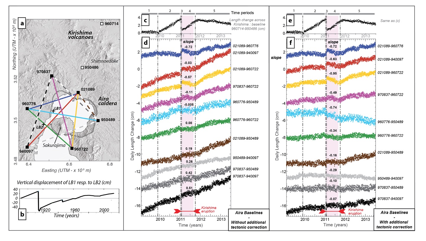
Figure 1. Volcanic induced deformation in southern Japan. (a) Map of Aira caldera and Kirishima volcanic group in Kyushu showing leveling benchmarks (LB) and GPS baselines used in (b,c,d,e,f) plotted over the shaded relief map. (b) Vertical displacement LB1 compared to LB2 showing the caldera floor uplift over the last century. (c and e) Baseline change across Kirishima (see stations in a). (d) GPS baseline length evolution over Aira caldera in the case of non-graben corrected data. Color-coded solid and dashed lines on (a) correspond to the top 6 and bottom 4 series on (d), respectively. Time-periods 1–5 on (c) are defined by changes in Kirishima deformation patterns (grey vertical dash-dotted lines). The pink box indicates Shinmoedake eruption. The slopes of linear fits of baseline length changes during period 4 are indicated (cm/year). (f) GPS baseline length evolution over Aira caldera in the case of graben-corrected data. Same color-coding and slope indications as in (d). [Source: Brothelande et al., 2018]
Tectonic research publications: Wdowinski et al. (2004); Wdowinski et al. (2006); Wdowinski et al. (2007); Wdowinski (2009); Sadeh et al. (2012); Weber et al. (2015); Brothelande et al. (2018);