|
|||||||||
|
|
|
||||||||
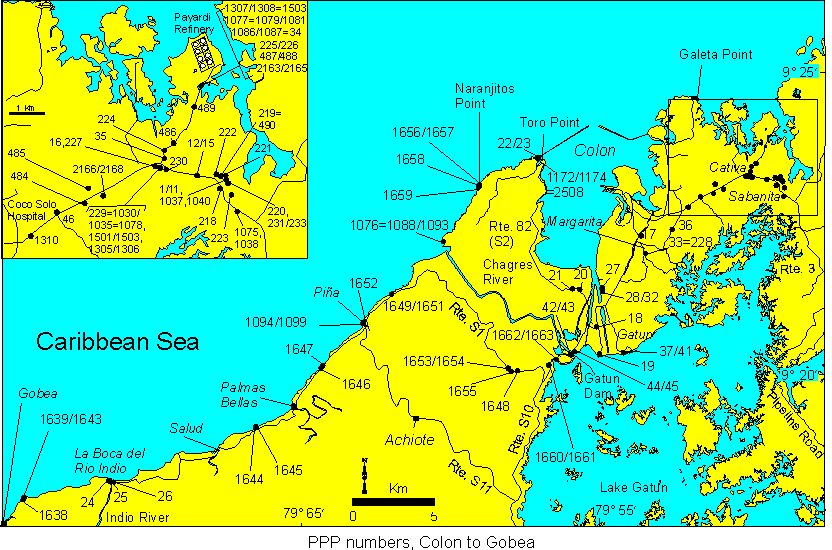
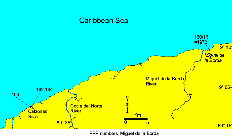
Maps of PPP Collecting Sites
Maps showing PPP numbers of collecting sites for the Caribbean side of Panama
and Costa Rica can be viewed below. The maps are modified versions of those
published by A.G. Coates in Appendix A of "A Paleobiotic Survey of Caribbean
Faunas from the Neogene of the Isthmus of Panama" (L.S. Collins and A.G. Coates,
editors): Bulletins of American Paleontology no. 357.
Colon to Gobea, Panama Canal
area
Miguel de la Borda, NW coast
of Panama
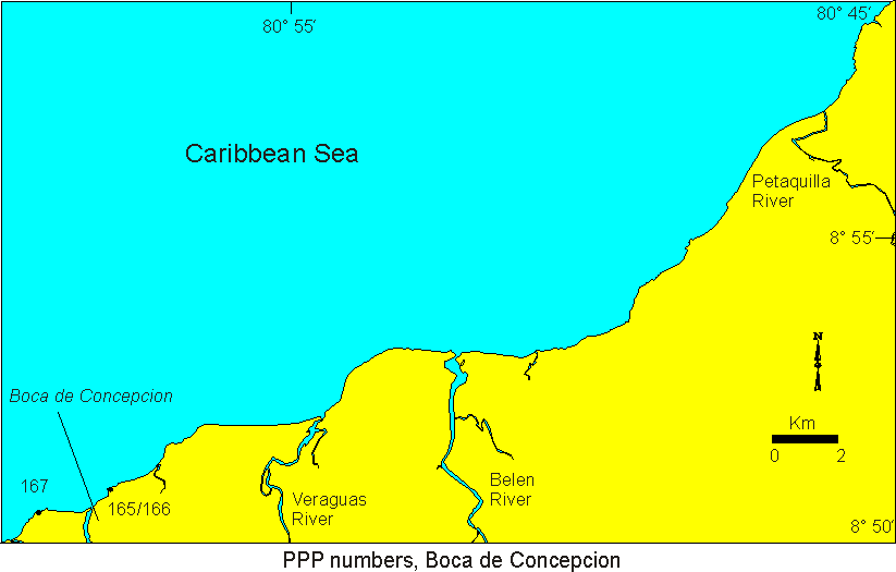
Boca de Concepcion, NW coast
of Panama
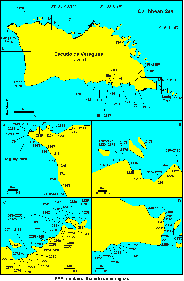
Escudo de Veraguas, Bocas
del Toro, Panama
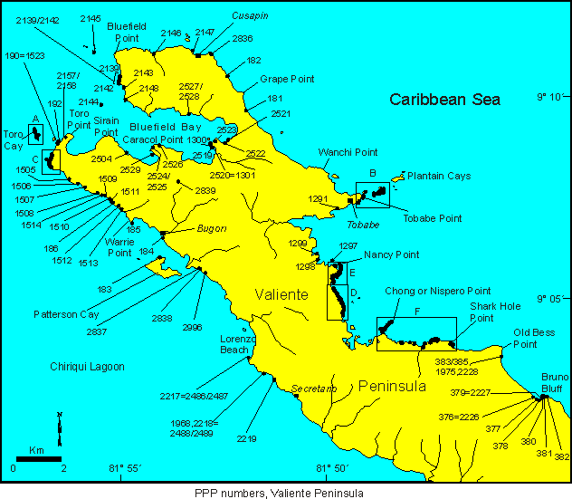
Valiente Peninsula, Bocas
del Toro, Panama, map of whole peninsula
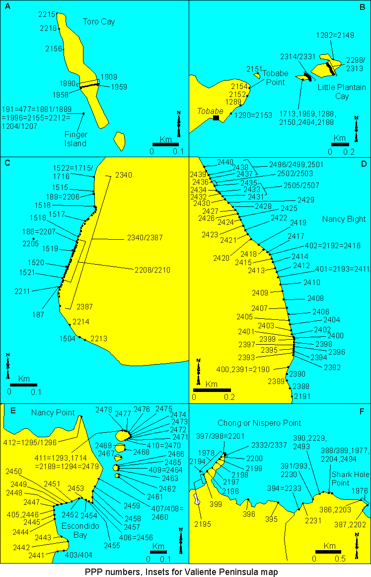
Valiente Peninsula, Bocas
del Toro, Panama, insets of map of whole peninsula
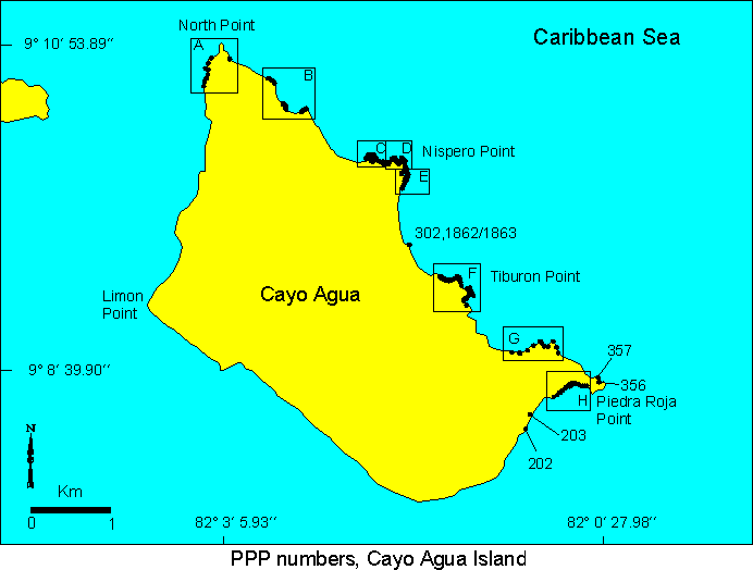
Cayo Agua Island, Bocas del
Toro, Panama, map of whole island
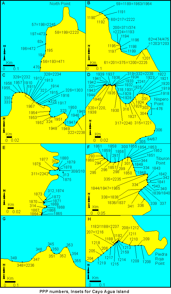
Cayo Agua Island, Bocas del
Toro, Panama, insets of map of whole island
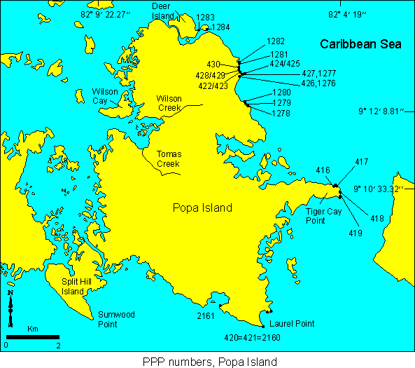
Popa Island, Bocas del Toro,
Panama
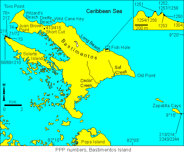
Bastimentos Island, Bocas
del Toro, Panama
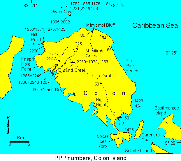
Colon Island, Bocas del
Toro, Panama
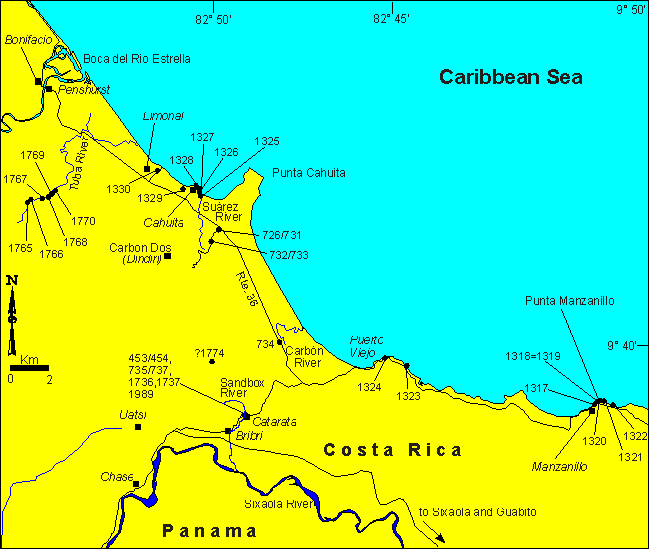
Southeastern Costa Rica,
Punta Cahuita area
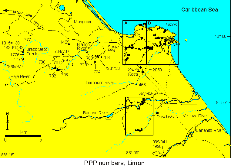
Limon region, Costa Rica
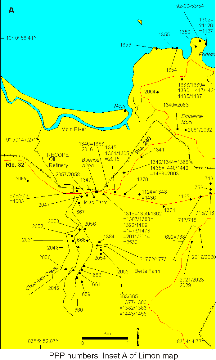
Portete area of Limon region,
Costa Rica, Inset A of map of Limon region
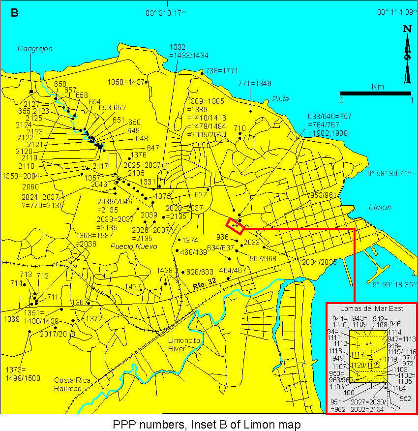
City of Limon, Costa Rica,
Inset B of map of Limon region
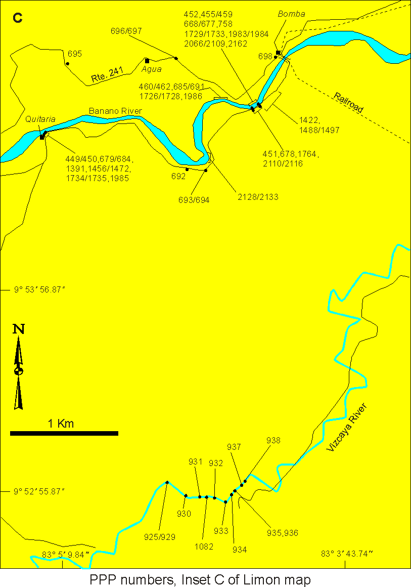
Bomba area of Limon region,
Costa Rica, Inset C of map of Limon region
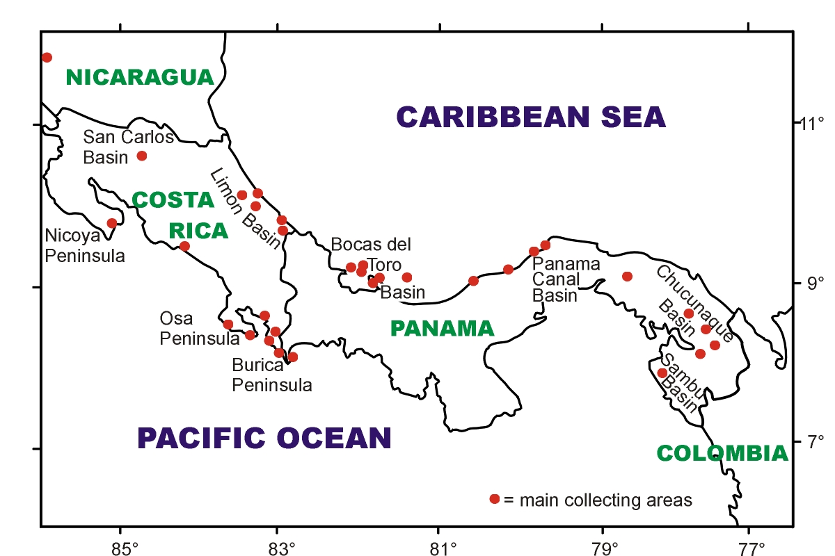
Below are shown PPP collecting localities in Central America.