Natural hazards
My hazard research has focused on tectonic and non-tectonic geological hazards, as well as on coastal flooding hazard. Geological hazards are ground-moving or shaking processes that can cause loss of life or severe property damage. The most destructive geological hazards are earthquakes and volcano eruptions, which occur in response to tectonic forces acting within or below the crust. Non-tectonic geological hazards are ground-moving phenomena occurring at shallow depths (typically <1 km) in response to weakening processes of certain geological units and gravitational forces. Tectonic-induced hazards, as earthquakes, can be very destructive, but typically occur during very short time periods (seconds for earthquakes to days for volcanic eruptions) with long quiescence periods between events. Non-tectonic geological hazards, as land subsidence, typically occur slowly, but their accumulated impact can lead to severe damage, mostly to property.
Cascading hazards are a sequence of hazardous events triggering one another. The classic example of a cascading hazard sequence is an earthquake triggering tsunami or landslides. Recently, we began investigating cascading hazards between wet typhoons, landslides, and earthquakes, as part of a NASA-supported project. Our study focuses on probably the best example for such cascading hazards, which occurred in central Taiwan following the 2009 Morakot Typhoon, which was the wettest typhoon in Taiwan’s record. The typhoon poured more than 2900 mm of rain within 4 days and caused a vast number of landslides (> 20,000). Six and nine months after the typhoon, two M>6 earthquakes hit the very same area. In our study, we hypothesize that the earthquakes were triggered by surface mass unloading induced by the wet typhoon and the landslides. More information on this project is available in the cascading hazards project website.
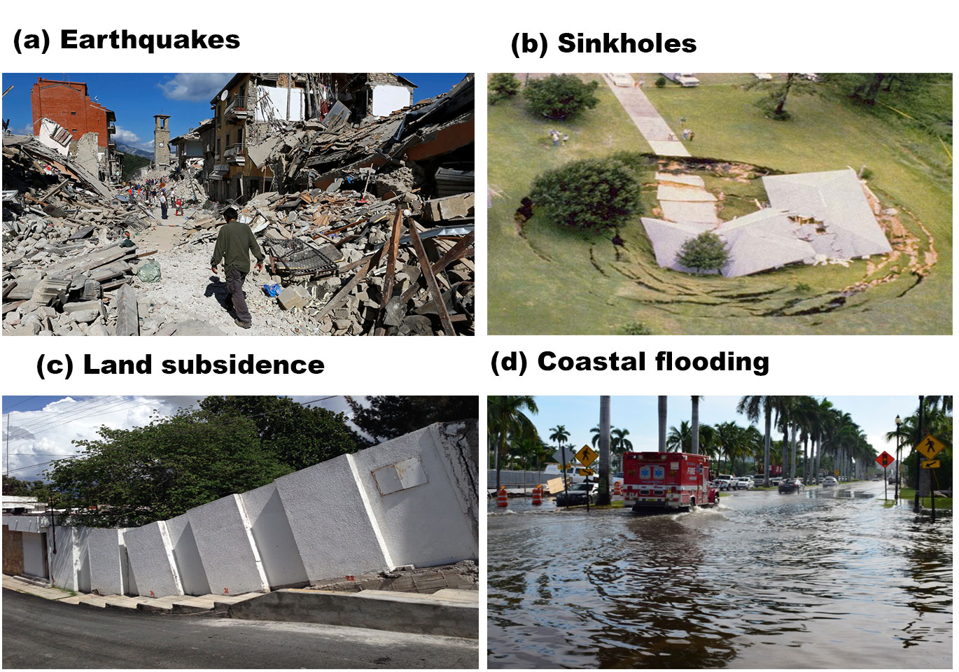
Figure 1. Images of damage induced by natural hazards.
My earthquake research has mostly relied on geodetic observations for characterizing the earthquake deformation cycle, which includes the following stages: inter-, co-, and post-seismic deformations. Using both GPS and InSAR observations, we detected inter-seismic deformation along the San Andreas Fault and the Dead Sea Fault and inferred the strain accumulation rate along these two fault systems. We also detected co- and post-seismic deformation following large earthquakes in California and Albania and inferred the energy released by the earthquakes. Recently, we investigated earthquake interaction and earthquake triggering central Taiwan as part of a NASA-supported project on cascading hazards. More information on my earthquake research can be found in the section Earthquake research.
Non-tectonic geological hazards are other research topics that we have conducted using precise geodetic observations. My research has focused on monitoring land subsidence and sinkholes using mainly InSAR time-series observations. We monitored land subsidence in both coastal and inland areas, including central Mexico, the US Atlantic coast, Venice, and Maipo City in Korea. My sinkhole detection studies have focused on western central Florida, where sinkhole activity has occasionally caused severe property damage and even resulted in a life toll. More information on my non-tectonic geologic hazard research can be found in the sections land subsidence and sinkhole research.
In recent years, I also researched the impact of seal level rise on coastal flooding hazard in Florida. More information on coastal flooding hazard can be found in the section
Sea level rise and coastal flooding hazard.